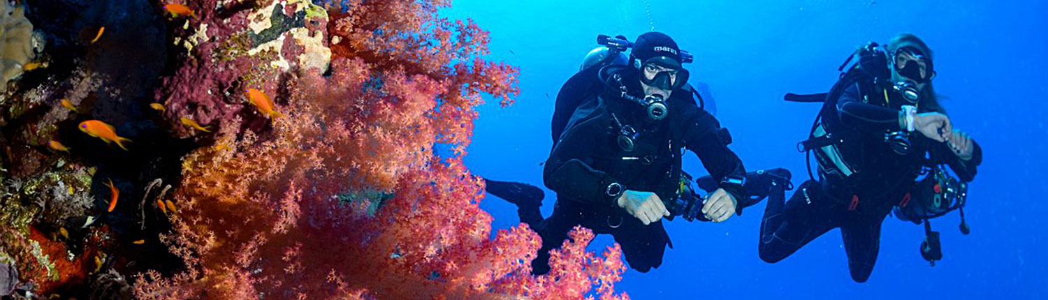
DISCOVER
the underwater world of
HURGHADA

ABU HASHISH
BEGINNER |WALL/DROP OFFCLEANING STATION| MAX DEPTH: 18 METER
Location
GPS – POSITION 27° 00.74′ N 33° 55.44′ E
Abu Hashish is the island at the centre of a wide bay 90 minutes south of Hurghada. The island was once used as drop-off point for smugglers bringing hash into the country. A tongue of reef extends about 1km south of the island. The dive site is at its southernmost tip. There is a shelf between 15 and 22m outside, and beyond that a steep, but fairly bare, drop-off, usually with superb visibility. Inside the tongue of reef is a scattering of long ergs.
Sea condition - Dive Plan - Marine Life
- Sea Conditions – Rough seas often make this site inaccessible from Hurghada although the site itself is well protected. Current is mainly north to south and strongest along the drop-off.
- Dive Plan – Leave the lagoon through an obvious channel filled with table corals, cross the shelf to the drop-off and follow it north. There are some beautiful caves in the 30m region. Return along the inside of the shelf and finish the dive back in the lagoon amongst the ergs.
- Marine Life – Along the drop-off pelagics such as jacks, barracuda, Spanish mackerel, whitetips and, now and then, hammerheads and feathertail rays. On the shelf, turtles, bluespotted rays, Spanish dancers, morays, lunartail and leopard groupers. In the lagoon, squid and baby barracuda schools.

BANANA REEF
BEGINNER / ADVANCED |DRIFT DIVING / NIGHT DIVE / MACRO SPOT / CLEANING STATION / SNORKELING PINNACLE, NEEDLE, SEAMOUNT| MAX DEPTH: 18 METER
Location
GPS – POSITION 27° 13.16′ E 57.04′E
Just off the end of Ben el Gebel in the middle of the Giftun Strait sits Banana Reef. It is also known as Gota Ben el Gebel, Gota Torfa el Shait or more poetically Shaab Farina (meaning “dragonfly reef,” look at its shape to see why). It’s a Y-shaped reef lying in shallow water (15m))
Sea condition - Dive Plan - Marine Life
- Sea Condition – It’s pretty well sheltered to the south of the reef where the moorings are. Current can often be very strong. Being in shallow, sandy water the visibility drops dramatically in bad weather.
- Dive Plan – you can moor up and dive on either side of the reef. The northeast point has some shallow caves. The northwest point, on the other hand, has a particularly stunning erg. Don’t waste time on the lee (south) side of the reef. It is naturally dead. Head towards the outer reef. At the corner is a fan shaped boulder that is home to a school of bannerfish. Here you should turn away from the main reef and head west 20m away is a 4m high pinnacle, carpeted in purple soft corals, another 20m beyond that is the erg. It is overhanging on the south side with a “nest” of coral fragments beneath. The north side is sloping and also carpeted in pink, purple and lilac soft corals. Beyond it is a gorgonian clad boulder. To the north the reef slopes to 20m+.
- Marine Life – Mainly bannerfish but also unicorns, emperor angelfish and puffers.

CARELESS REEF
ADVANCED / EXPERT| WALL/DROP OFF | MAX DEPTH : 25 METER
Location
GPS – POSITION 27° 18.80′ N 33° 56.45′ E
About one hour northeast of Hurghada, amid-sea reef plateau pushes up from the abyss. It is mostly in the 12-25m range, gently sloping to 22-24m at its edges where it drops off steeply. Standing on the plateau are two ergs, the larger to the northwest, the smaller to the southeast. They are surrounded by a forest of coral that swarms with fish.
Sea condition - Dive Plan - Marine Life
- Sea Conditions – The ergs offer no protection from the sea and this lack of a decent anchorage has saved Carless from its own popularity (divers can’t get here every day). The current is unpredictable. On the surface, it always comes from the north but deeper down, it has been known to run any which way.
- Dive Plan – There are two good dives here. Firstly, drop into the north of the ergs and head south along the eastern drop-off finishing on the southern erg. Alternatively, dive from the moorings taking time to explore both sides of the plateau and circling the ergs in a figure 8.
- Marine Life – This place is crawling with just about everything. On the plateau keep an eye out for free swimming morays, whitetips, turtles and to the north a school of bannerfish. On the drop-off look for tuna, giant trevallies, huge groupers and in the early morning hammerheads.

EL ERUG
BEGINNER / ADVANCED / EXPERT | PINNACLES | MAX DEPTH: 14 METER
Location
GPS – POSITION 27° 10.00′ N 33°57.
Around 60 mins from central hurghada .
Sea condition - Dive Plan - Marine Life
Sea Conditions – Fairly sheltered south of the giftun islands , this is a good choice for all levels of diver and training .
Dive Plan – Through this is often considered to be one dive site, there are actually three : beginning from the southwest with Erug Diana, via Erug Giftun in the middle and finally, Erug Gigi in the northeast.
Marine Life -This site is the habitat of a variety of species of moray eels including yellowmouth, giant, snowflake and peppered . you are also likely to bump into napoleon wrasse, blue spotted rays, crocodile fish and scorpionfish.

EL FANADIR
BEGINNER /ADVANCED|WALL/DROP OFF/DRIFT DIVING| MAX DEPTH: 25 METER
Location
GPS – POSITION 27° 17.29′ N 33° 50.28′ E
Fanadir is a long narrow reef just north of Hurghada. It can be dived on the south end, on the east side or in good weather, on the north end. The illustration shows the east side, which is the most popular as it is protected from the wearher by a slight curve in the reef. It is marked by 4 low lying rocky islets. A shallow hard coral wall slopes(at about 60°) to a sandy ledge at 12m. This sandy ledge is about 50m wide and narrows as you head northwards. At 20-25m, it drops off to greater depth.
Sea condition - Dive Plan - Marine Life
- Sea Conditions – Current comes from the north and is usually mild. The south end and east side are protected from northerly or northwesterly winds (most of the time).
- Dive Plan – The drop-off is naturally sandy, devoid of coral and fairly depressing. Don’t waste your time here, you should be shallow, heading out at 12-15m and returning at 3-4m. In fact, the shallower the better. There is a small but very photogenic coral block at 14m and just north of the islets. It has glassfish, cardinal fish, soft corals, etc. and usually a resident stonefish. 100m north of here are some impressive gorgonians.
- Marine Life – This place is crawling with pipefish. They must provide food for the stonefish, scorpionnsh and hump-back scorpionfish which abound. If you had to choose any one site to look for stonefish, this should be it. Near the surface is teeming with silversides and occasionally small packs of tuna and jacks cruise by hunting them. Other residents include snowflake morays, yellow mouth morays, octopus and lots of lionfish. There have also been reports of frogfish, guitar sharks, mantas, and even a hammerhead at this site.

EL MINA
ADVANCED | DROP OFF / DRIFT DIVING | MAX DEPTH:32 METER
Location
GPS – POSITION 27° 13.92′ N 33° 51.57′ E
Just east of Hurghada harbour, El Mina is an Egyptian minesweeper sunk around 1969 by Israeli fighter planes. She rests on a rocky seabed sloping from 25m under the bow to 32m at the stern. The wreck lies on a northwest-southeast axis on her portside. There has been an attempt in the past to rename her “The Israeli Torpedo Boat” but it should be obvious that her starboard anchor and a hundred metres of chain are paid out, hardly a fighting manoeuvre. Also there is no hardware for the firing of the alleged torpedoes.
Sea condition - Dive Plan - Marine Life
- Sea Conditions – It is always calm here, in fact the wreck is a bad weather alternative for those turning back from a blown out trip to the wrecks at Abu Nuhas. Current can scream through here from the north, but there is always shelter behind the decks of the ship. Visibility is usually somewhere between poor and disastrous.
- Dive Plan – The wreck is only 60-70m long, so no need to rush. The aft section is bristling with winches and anti-air- craft guns whilst the fore-deck guns have been sheared off. The blast-hole area is suitable for penetration, though else where it is inadvisable. All around, on the seabed are live shells – look but don’t touch.
- Marine Life – The wreck is generally fish-free and surprisingly encrusted by coral except for a few notable exceptions. The blast-hole allows vast hoards of glassfish to shelter from groups of marauding jackfish. In this area is also a lone anemone. Leave the clownfish alone, it is already exhausted from defending its turf against dozens of divers every day. Instead, go and have a look under the flukes of the anchor (not the paid out one). It harbours a thicket of black urchins amongst whose spines lurk several cleaner shrimps.

ERG ABU RAMADA
BEGINNER |WALL/DROP OFF | MAX DEPTH: 30 METER
Location
GPS – POSITION 27° 9.78′ N 33° 59.04′ E
On the southeast side of Abu Ramada (80 minutes out of Hurghada) is a wide sandy shelf stretching eastwards. Just before it drops off, three large ergs rise up from the seabed (18m) to just beneath the surface. They lie in a line, the biggest to the south and the smallest to the north.
Sea condition - Dive Plan - Marine Life
- Sea Conditions – Much of the time, this site is too rough to dive as it is very exposed. Spared the ravages of divers, it has retained its untouched beauty. All previous adjectives to describe current fail here. To say it rips is an understatement most of the time. And yet occasionally it is as calm and placid a place as you could ever want to dive.
- Dive Plan – Don’t waste your time going to the drop-off (30m to the east). There are better places for that. Your air is more wisely used circling the three ergs at ascending depths. Visit the small eaves on the east side of the largest erg and north side of the middle one. The north sides have a particularly healthy growth of purple soft corals (due to the prevailing current) and the shallows are also very prolific. This is amust for photographers.
- Marine Life – It would be easier to list what you don’t see than what you do, but most obvious are morays, napoleons, tuna, barracuda, unicorn schools, groupers and a cloud of millions of tiny anthias.

ERG SABINA
BEGINNER | WALL/DROP OFF | MAX DEPTH: 12 METER
Location
GPS – POSITION 27° 12.99′ N 33° 57.27′ E
About 150m from Shaab Sabina; Erg Sabina is a small isolated reef in the middle of the Giftun Strait. It sits on a sandy seabed between 10 and 12m. To the east and west are gardens of fire coral and to the north there is a smaller erg, home to glassfish and great for photography.
Sea condition - Dive Plan - Marine Life
- Sea Conditions – Perfectly calm but often a steaming current.
- Dive Plan – There’s only one dive plan for a small erg like this. Go round it. Don’t waste time on the south side which is dull, but make sure you get to the small northern erg. On the west side is a white sand patch, home to a large school of goatfish.
- Marine Life – Turtles, big puffers, goatfish schools, Arabian angelfish, emperor angelfish, nudibranchs, lobster and a lot of small reef fish..

ERG SOMAYA
BEGINNER | WALL/DROP OFF | MAX DEPTH: 60+ METER
Location
GPS – POSITION 27° 11.93′ N 33° 58.97′ E
About 75 minutes outside Hurghada, on the east side of Giftun Soraya, is Erg Somaya. To the south is the tower of Giftun police station, to the north is a prominent ridge of mountain. The reef slopes steeply to a sandy ledge between 15m and 24m, beyond which it drops o 50m+. There are two pinnacles on the ledge. One between 18m and 10m has a mooring buoy attached. To the north between 20m and 12m is another shaped like a pyramid and overgrown with a thick crop of purple soft corals. Beneath the ledge and between the two ergs is a distinct nose with two caves at 25m and 32m joining to form a chimney.
Sea condition - Dive Plan - Marine Life
- Sea Conditions – The moorings are very close to the reef so in rough weather it can be difficult to put a boat there. The area is ravaged by a strong current much of the time in which case it is easier to drift dive.
- Dive Plan – If you choose to drift then jump in to the north and surface at the boat which waits on the moorings. Alternatively, the site connects with “Small Giftun drift.” So drop in at the moorings and follow the wall southwards until you reach the south plateau of Small Giftun. Leave the drop-off and head to the shallow reef. Shortly after you round the corner you will start to sec the moorings, your boat should be waiting on one of these, Whichever way you dive it, make sure you visit the cave to be hypnotised by the billowing curtain of glassfish. Go through only if you’re experienced enough and take your time along the drop-off to admire the deep rich colours of soft corals and the gorgonians.
- Marine Life – Batfish, barracuda, tuna, jackfish, Spanish mackerel, napoleons, morays, tunics, groupers, and if you’re lucky, whitetips. Feeding on glassfish in the cave, lionfish and redmouth groupers. You can also find Spanish dancers here by daylight.

FANOUS EAST
BEGINNER | WALL/DROP OFF | DEPTH: 27 METER
Location
GPS – POSITION 27° 16.04′ N 33° 53.27′ E
This reef comes with several names: Torfa el Fanous (meaning “reef with a beacon”), Dolphin Reef or Dolphin’s Playground. Whatever name you give it, it’s a narrow strip of reef surrounding a large lagoon to the north-west of Giftun Kebir. On its east end a wide channel splits the reef from the mainland and on its slopes are a coral garden and three colourful pinnacles. It takes 45 minutes to an hour to get there.
Sea condition - Dive Plan - Marine Life
- Sea Conditions – Inside the lagoon is always calm though the north side of the reef is exposed to the weather. The current splits on the outer (north) reef and runs east and west, so you could drop in at the beacon and drift easily back through the channel.
- Dive Plan – Head out at about 15m taking in Erg ‘A’ (see illustration), the coral garden and Erg “B” (the glassfish erg). Take in the gorgonians on the corner before turning back.
- Marine Life – It is not uncommon to see a pod of 5 or 6 dolphins here even when diving. Turtles, bluespotted rays, eagle rays, jacks and barracuda also reside here. What makes the dive site particularly interesting though are the rarities such as pegasus living on the sand, an occasional frogfish and an even more rare stargazer.

FANOUS WEST
BEGINNER | WALL/DROP OFF | MAX DEPTH: 14 M
Location
GPS – POSITION 27° 15.85′ N 33° 52.79′ E
On the western end of the Fanous reef, a narrow “fossma” or channel breaks through the reef wall to a lagoon outside at 9m and an area of coral garden at 12-14m. There are two main ergs and various outlying coral pinnacles.
Sea condition - Dive Plan - Marine Life
- Sea Conditions – The boat can moor on the inside of the fossma in any weather. Here it can remain in the sanctuary of the Fanous lagoon while divers venture outside. The current will only run on the outer wall, direction northeast to southwest. It can run strong, in which case the best approach is a drift dive, dropping in north of the ergs and returning with the current to the boat at the moorings.
- Dive Plan – If you’re not taking the drift option (above) then head out through the fossma (4m). Don’t waste time in the lagoon (9m). It is naturally dead. At the corner you make a choice, either keep following the main reef northeast, or head straight out. There is a prominent coral lump about 20m ahead which lines you up with the main erg (50m away). It is nicest on the north end. To the south are two other large pinnacles.
- Marine Life – The usual reef fish and plenty of them – Picassos, painted triggers, morays, snowflake morays, octopus, squid, butterflyfish and turtles. Dolphins regularly pass through in the afternoon, usually heading north to south.

GOTA ABU RAMADA
BEGINNER | WALL/DROP OFF | MAX DEPTH:15 M
Location
GPS – POSITION 27° 11.93′ N 33° 58.97′ E
This reef, also known as the aquarium, lies between 50 and 90 minutes from Hurghada depending where you depart from. It is an elliptical reef surrounded by a sandy seabed at 12-15m. To the west are two large ergs and to the east are three pinnacles and a coral garden.
Sea condition - Dive Plan - Marine Life
- Sea Conditions – The sea is usually calm. At its worst a little swell can be felt curling round the east and west corners of the reef. The current splits on the northern reef and, like the sea, can only really be felt at either end of the reef.
- Dive Plan – a) The east side is ideal for photographers. The area is teeming with yellow fish amongst the gullies and grottoes that characterise this end of the reef. About 15-20m off to the southeast are three small pinnacles with abundant fish life. b) Two larger ergs stand 20m off the west end of the reef. They are typified by soft corals, gorgonians and stacks of fish.
- Marine Life – All over the reef, but especially at the west end, there are yellow fish, bannerfish, bluecheek butterflies, masked butterflies, yellow snapper, goatfish and sweetlips. Big morays, jacks, turtles, crocodile fish and more infrequently, eagle rays and leopard sharks visit the reef. Titan triggerfish are guarding their nests in September. Watch out.

HAMDA
BEGINNER | WALL/DROP OFF | MAX DEPTH: 15 M
Location
GPS – POSITION 27° 14.25′ N 33° 55.73′ E
Hamda is situated on the northeast side of Giftun Kebir, beneath a series of prominent cliffs and opposite a white, shingle beach. It goes by several names: Hamda, Umm Dom, Hamata or Stone Beach for starters. Beneath the water is a small plateau of hard coral sloping easily from 15 to 35m. On the outside, the plateau drops off in a series of smooth, rounded rocky ledges. At both ends the plateau gives way to a steep wall tumbling to 50m+.
Sea condition - Dive Plan - Marine Life
- Sea Conditions – If the wind is coming from the northwest the place is well sheltered, but from the north and north-east it is very exposed. Current is negligible.
- Dive Plan – It’s worth going to have a look at the drop-off, if only to remind yourself how much more life and colour there is shallow. It is stark, bare rock and somewhat lunar looking. Beneath the boat look out for a large green salad coral. As you head north across the plateau you will notice two large sand patches at 15 and 18m. Not far beyond here the wall starts. On your way back stay really shallow (3-4m), this is probably the best part of the dive.
- Marine Life – In open water above the plateau there are large schools of blue fusiliers and redfang triggerfish and, solitary tuna, snapper and unicorns. On the plateau you’ll find morays, scorpionfish, barracuda, maybe sharks or turtles and there are many cleaning stations where fish hover, mouths open, under the attention of cleaner wrasse. This has also been the scene of a couple of whale shark sightings.

NORTH ABU RAMADA
BEGINNER | WALL/DROP OFF | MAX DEPTH: 35 M
Location
GPS – POSITION 27° 10.41′ N 33° 59.07′ E
North Abu Ramada is between 60 and 90 minutes out of Hurghada. Where the island stops at the north end a long platcau continues at 20-50m, tailing gently off. On the east side it drops off sheer, blending with a vertical wall to the south. Like Umm Gamaar, there is a “Halg” or neck on the east side of the island where your boat can often wait.
Sea condition - Dive Plan - Marine Life
- Sea Conditions – Usually too rough to moor up (except at the Halg), so the dive is done as a drift dive. Occasionally, during a south wind, boats will tie up on the plateau. A bullish current stampedes across the plateau much of the time. It makes for some thrilling diving but take care.
- Dive Plan – Unless you are lucky enough to moor here, then drift dive it. Jump in directly north of the reef and head immediately east to the drop-off.On your way, you should pass a large coral block from 15 to 20m. The drop-off is at 25m. Just past here is an inconspicuous hump with its top at around 20m. It is packed with small holes which suggest it is hollow. It is. Follow it down to 31m where you can enter aspacious cave that chimneys up towards 25m. It is located just north of where plateau turns into wall. After the caves follow the wall south. It is vertical and the water is very blue. If your skipper Is smart (and the sea allows him) he has moored up in the “halg” (opposite a small beach). You can join him there.
- Marine Life – There is not awhole lot of small fish here but barracuda, tuna and jacks arc common. Even sailfish have been spotted here, and now and then hammerheads.

NORTH UMM GAMAAR
BEGINNER | WALL/DROP OFF | MAX DEPTH: 40 M
Location
GPS – POSITION 27° 21.100′ N 33° 54.300′ E
Around 90 mins from central Hurghada .
Sea condition - Dive Plan - Marine Life
- Sea Conditions – It has to be fairly calm to even try to moor here because the boat swings very close to the reef. Current picks up as you head northwards.
- Dive Plan – Take in the deep coral blocks first (if you have the necessary experience), then head either way. If you head north, take care not to pass the point at which the current splits. This could result in you getting swept around the corner. If you head south, look out for black coral trees. There is also a cave at 8m just beyond a prominent cleft in the reef top.
- Marine Life – The most common fish here are lunartail and peacock groupers, unicornfish, sohal and orangespine surgeonfish, bannerfish and bluecheek butterflyfish are also in abundance. This reef is special for one thing in particular – Spanish dancers during the day. They are usually between 15 and 20m but they appear as shallow as 4m.

RAS DISHA
BEGINNER | WALL/DROP OFF | MAX DEPTH: 18 M
Location
GPS – POSITION 27° 02.47′ N 33° 53.40′ E
About 90 minutes south from Hurghada, on the coast, is a wide bay with an island at its centre (Abu Hashish). It is defined to the north by a headland called Ras Disha. There is a plateau of shallow sand and past the beacon, to the north is a drop-off. Three ergs lie to the south. They are probably the nicest diving.
Sea condition - Dive Plan - Marine Life
- Sea Conditions – The dive site is well sheltered from waves and current which come predominantly from the north.
- Dive Plan – Forget the main reef. It is largely dead. The best route to take is around the ergs. They rise up from a sandy seabed at l0-12m. The most northerly has a large cavern thick with glassfish.
- Marine Life – On the ergs, the usual hunters of glassfish – jacks, lionfish and redmouth groupers. This place also has the richest sand-dwelling fauna around-crocodilefish, flatfish, stonefish, spiny devilfish, bluespotted rays and sea moths come as standard. On the wall to the north, a grey reef shark is rumoured to hang out, and on the sandy plateau and between the ergs schools of juvenile barracuda.

SHAAB ABU NUGAR
BEGINNER | WALL/DROP OFF | MAX DEPTH: 14 M
Location
GPS – POSITION 27° 20.45′ N 33° 50.20′ E
About 60-90 minutes north of Hurghada, Abu Nugar is composed of a long t-shaped reef to the west and a shallow plateau dotted with ergs to the east. Diving takes place on the most south-easterly ergs (Shaab Ins), two large central ergs (Gota Abu Nugar), or on the north side of the tongue pointing west from the main reef. The name Abu Nugar literally means “Father of the Pools” and refers to several clear blue lagoons in the reef top.
Sea condition - Dive Plan - Marine Life
- Sea Conditions – It can get a little choppy on the way over but once you get there you’re well sheltered. Current is usually mild.
- Dive Plan – Some parts of this reef system are utterly dull; whilst others offer superb shallow diving with an almost virginal quality to the reefs. If you can, dive the three ergs north of the tongue – they are magical.
- Marine Life – Shaab Abu Nugar presents a huge variation of marine life . keep an eye out for macro life like nudibranchs , as well as longer creatures . there are serval cleaning stations around where groupers and snappers line up a brush-up by shrimps and wrasses . the corals are in very good condition in most places.

SHAAB ESHTA
BEGINNER | WALL/DROP OFF | MAX DEPTH: 12 M
Location
GPS – POSITION 27° 09.00′ N 33° 53.66′ E
Shaab Eshta is 45 minutes to one hour from Hurghada. It is basically two ergs, a small one to the north, a large one to the south and it is shaped a bit like a clover leaf. Eshta is Arabic for “cream” but it’s also a term of phrase equivalent to “cool” in English. The depth ranges from 9 to 12m and it is surrounded by areas of turtle grass.
Sea condition - Dive Plan - Marine Life
- Sea Conditions – The sea is calm more often than not and the current is always light except in the channel between the two ergs.
- Dive Plan – It’s a small dive site and you can circle it twice in a figure 8 at different depths. Head out into the turtle grass beds, where you’ll find a wide variety of unfamiliar fish.
- Marine Life – In the turtle grass look for packs of lionfish, bluelined emperors, southern stingrays, turtles and sea horses. In the gap between the ergs, there is a school of goatfish plus sweetlips, snappers and on the rubble slope, stonefish, humpback scorpionfish and crocodilefish. There is also a small cave which at night shelters a turtle. A small gully on the southern erg houses a school of hatchetfish and finally, look out for a large Malabar grouper which patrols the area.

SHAAB PETRA
BEGINNER | WALL/DROP OFF | MAX DEPTH: 15 M
Location
GPS – POSITION 27° 09.02′ N 33° 53.42′ E
45 minutes southeast from Hurghada two ergs come to the surface from an 8m sandy seabed. They are about 50m apart on an east-west axis. To the east of these ergs is a small coral block (the best part of the dive).
Sea condition - Dive Plan - Marine Life
- Sea Conditions – Usually calm with a mild current from the northeast or northwest.
- Dive Plan – Spend your time on the eastern erg and its outlying block. The block is teeming with life and will impress even the most jaded diver.
- Marine Life – The coral block has a few large holes containing glassfish and hatchetfish which spill out onto the surrounding reef. Above swarm silversides and tiny goatfish. Orange spot and bluefin trevallies hunt amongst them. The main ergs are not as interesting but have various large holes, home to squirrelfish, soldierfish, cardinal fish, glasseyes and hatchetfish.

SHAAB SABINA
BEGINNER | DROP OFF | MAX DEPTH:14 M
Location
GPS – POSITION 27° 12.98′ N 33° 57.26′ E
This reef, also known as Fufuleya, lies 60-90 minutes from Hurghada. It is marked by a pointed tongue of reef poking out from the east side of Giftun Kebir. To the south side of the tongue it is basically dead. To the north though is an attractive hard coral garden that extends northeastwards as a succession of alternating coral ridges and sand patches. There is a beautiful shallow lagoon 150m past the tongue.
Sea condition - Dive Plan - Marine Life
- Sea Conditions – Perfectly calm on the surface but you may encounter occasional strong currents during the dive.
- Dive Plan – This is best dived as a drift. Jump in 200-300m past the point and weave your way back to the moorings through the coral garden. If you can locate it then spend some time in the shallow lagoon basking in the sun. Its entrance is at 2-3m.
- Marine Life – Shaab Sabrina is mainly dived for its impressive coral landscape, not for its fish life. Nevertheless, expect to see puffers, turtles, bannerfish, bluecheek butterflyfish, cornettfish, various surgeonfish, broomtail wrasse and bicolour parrotfish. In the lagoon are cornetfish, clams, pencil urchins and yellow chromis in an oasis of staghorn hushes and plate firecoral.

SHABRUHR UMM GAMAAR
BEGINNER / ADVANCED | WALL/DROP OFF | MAX DEPTH: 40 M
Location
GPS – POSITION 27° 21.55′ N 33° 54.55′ E
Like Umm Gamar, less than one mile to the north, Shaabruhr is a thin slice of reef lying on a north south axis. Unlike Umm Gamar it has no island or beacons to mark its surface. For this reason it has claimed three ships, the wrecks of which now lie beneath the surface. On the southernmost point is the remains of an old Egyptian vessel that used to supply the army on Shadwan Island. There is also a dive safari boat at great depth and from more recently, the famous Colona IV also at great depth. All around the island is a plateau between 15 and 30m. It is narrow on the south and east sides and broad and sandy to the west. The north end has a ridge that extends at 25-30m for several hundred metres. Shaabruhr simply means small reef.
Sea condition - Dive Plan - Marine Life
- Sea Conditions – Shaabruhr offers less shelter than Umm Gamar but it’s usually okay to moor up. Current can run quite strong down the east side, though the mooring area is usually calm.
- Dive Plan – There are two good dives here. Either drift the east wall,or dive the south plateau, taking in the wreck and drop-off beyond it. Return along the shallow reef where there are numerous small caves and overhangs. Finish the dive shallow on the mushroom shaped erg.
- Marine Life – On the plateau, you may cross paths with morays, napoleons, large groupers and bluespotted rays. On the drop-off are whitetips, jackfish and some big tuna. This is the best place in Hurghada to look for grey reefs (especially in the afternoon).

SMALL GIFTUN
BEGINNER | WALL/DROP OFF | MAX DEPTH: 25 M
Location
GPS – POSITION 27° 11.17′ N 33° 58.94′ E
round 80 minutes from central Hurghada, opposite the small Giftun police station there is one dive that invokes more enthusiasm than any other. It is a drift along a gorgonian clad wall chat merges with an extensive plateau and drop-off . The plateau lies between 15 and 25m and the wall apparently has no bottom.
Sea condition - Dive Plan - Marine Life
- Sea Conditions – Sometimes choppy near the drop-in point but your boat will wait in the calm water of the moorings, close to the blue lagoon. Current is always from the north, but is unpredictable – sometimes mild, sometimes howling.
- Dive Plan – Where you drop in depends on how good you are on air and how deep you intend to go. Opposite the two beaches is a safe bet. Opposite the tower is also possible. Put your right shoulder to the reef and head south. There are caves at 35m and a tunnel leading from 40 co 45 (out of bounds for most dive centres). Where the plateau starts, you can continue following the drop-off but take care not to go too far or you’ll lose the main reef.
- Marine Life – On the plateau, napoleons and morays are guaranteed. This is because they have been fed in the past. Feeding marine life disrupts the natural ecosystem, please don’t do it. There are also many bluespotted rays, painted triggerfish and crocodilefish. On the drop-off are turtles, jackfish and early in the morning, a very good chance of sharks. In September, beware of titan triggerfish.

SOUTH ABU RAMADA
BEGINNER | WALL/DROP OFF | MAX DEPTH: 30 M
Location
GPS – POSITION 27° 9.51′ N 33° 58.74′ E
60-90 minutes away. On the southern end of Abu Ramada a small islet and 3 large boulders are separated from the main island. The dive site is on the reef south of here. To the east of the mooring points a sloping wall tumbles away to 35m. A long swim away is a bubble-like grotto with several entry points. It is filled with many varieties of soft coral, sweepers, cardinalfish and soldierfish. To the southwest are numerous shallow pinnacles with abundant fish life. The seabed here is a bare, lunar looking concretion of compacted sand.
Sea condition - Dive Plan - Marine Life
- Sea Conditions – Always calm except on a southerly wind (rare). Current is mild (if at all) at the east and west corners.
- Dive Plan – Head west from the moorings at about 25m. The deepest of the pinnacles is at about this depth. It has a split running through the middle that looks like the mouth of a clam shell. It provides sanctuary to soldierfish, glasseyes, hatchetfish and also sweetlips. From here, head onto a shallower shelf behind, this is where the remainder of the pinnacles are. Spend your time here, returning shallow along the main reef.
- Marine Life – Numerous free swimming morays, bannerfish, napoleons, emperorfish, sweeclips, unicorn fish, goatfish and squid.

BEN EL GEBEL (TURFT EL SHAHED)
BEGINNER | WALL/DROP OFF | MAX DEPTH: 20 M
Location
Between Giftun Soraya and Giftun Kebir is a narrow strait. Along crescent of reef projects out into it from the north end of Giftun Soraya – this is Ben el Gebel (literally «between the mountains» in Arabic). It also goes by the names of Shaab Torta, Shaah Dorfa and Torfa el Shait. At the end of this crescent of reef are five ergs. This is your dive site. It’s about 90 minutes from Hurghada.
Sea condition - Dive Plan - Marine Life
- Sea Conditions – Though waves may be pounding on the outside reef and the wind may be howling, the lagoon stays calm. You can venture out through the channel. This whole area is washed by current which runs through the strait much of the time.
- Dive Plan – Exit through a channel at 8m. If you’re feeling lazy then go no further than the three closest ergs. There are some beautiful gorgonians on their north end. If you’re feeling athletic then head out to the furthest erg, it’s not dived much so it is full of fish and has some impressive overhangs veiled in glassfish. Be careful not to venture too far out into the strait, divers have been known to get lost and surface on neighbouring “Gota Ben el Gebel” or “Banana Reef” by mistake. It’s a long swim back.
- Marine Life – Painted triggerfish, putters, yellowspine tang, napoleons and one spot snapper populate the reef. Orange spot jacks hunt the glassfish beneath the overhangs. On the far north side barracuda and occasionally whitetips and eagle rays wander through. Close to the reef are clownfish living in large groups in their anemones.

UMM GAMAAR
BEGINNER / ADVANCED | WALL/DROP OFF/DRIFT DIVING | MAX DEPTH: 40 M
Location
GPS – POSITION 27° 21.178′ N 33° 54.548′ E
Umm Gamaar is a long thin streak of reef lying on a north south axis, 90 minutes north of Hurghada. To the north and south are small plateaus in the 20m range. On the cast side a vertical wall plunges into the silent blue beneath. It is most commonly dived on the south plateau (near the moorings) and the cast wall. Umm Gamaar means “Mother of the Moon”, possibly a reference to the crescent shaped wedge of island atop the reef.
Sea condition - Dive Plan - Marine Life
- Sea Conditions – Again, choppy on the way over, but protected once you get there. Current is not usually a problem. If there is any, you’ll find it on the southeast corner.
- Dive Plan – Where the east edge of the plateau merges with the wall there are three coral towers. The first is hollow and round and filled with glassfish, as is the second which is taller and more sculpted in shape. The third has a large sandy cave at 27m. All three are richly swathed in purple soft corals and a swirling mist of glassfish. What more could you need.
- Marine Life – On the plateau you are sure to encounter napoleons, morays, cornetfish, batfish and schools of bannerfish. Whitetips cruise by from time to time. In February/March mantas occasionally make an appearance and in September titan triggerfish are guarding their nests. On the coral towers the usual predators of glassfish can be located – stonefish, scorpionfish, humpback scorpions and lionfish.